
Wandering.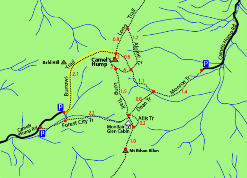
I posted about the trip on a slack server for Vermont techies listing the start time in case anyone wanted to join. I had to wake very early to make it to the trailhead on time, before the lot filled up too much. I left with plenty of time for the two hour drive, until I met up with traffic. About an hour into the trip a tractor was driving along the road, slowly. It had a long queue of cars behind so I’m not sure why it never pulled over, but eventually I made it around.
Then about 2 miles before the final turn, I saw detour signs, and more claiming the road was closed ahead. I turned around to follow the detour for a few miles but it was adding 30-45 minutes to the trip! Also I had a strong feeling that led me to turn back around and continue down the “closed†road. I was expecting to see a closure but never found any signs.

The trailhead was already getting busy and I had to park on the edge of the dirt road leading to it. After ensuring the car was safe, I extended my hiking poles, put the new day pack on and began wandering through the woods, along the Burrow’s Trail leading up to Camel’s Hump. The weather was nice, clear skies, sun shining with the slightest chill on bare skin. Perfect for hiking.
The trail was wide and well travelled with rocks scattered around the dirt path. Along the way a few ash trees shared information of the emerald ash borer, a beetle killing the ash trees in the north east, with a paper hanging off them. Up the trail I continued, eventually hearing a stream running along the side, and finding it further up the trail.

The path continued up at a quick pace. More like walking random steps than a nicely graded trail. Eventually I came to a small clearing and a trail junction with The Long Trail which would lead me the rest of the way to the summit, and there I would join more than 40 other hikers hanging around the top of Camels Hump.
From the top you could see out miles in every direction. Toward Mount Mansfield which I hiked a couple weeks before and out toward Mount Ellen which is another 4000 foot peak I’ll hike in the future. At the top I sat for almost an hour, just looking out at the vast world and watching people come and go.

Immediately during the descent of the mountain I began feeling my left knee. Instantly. On the first step. This was going to be a long way down.
Getting to that first clearing was easy enough, but beyond that I needed to take breaks often. I stopped for every hiker going up, and there were many. Eventually I made it down the mountain and back to the car. My knee was in pain but not nearly as bad as the climb up Mount Mansfield. I collapsed the hiking poles, took a last big drink of water, tossed the day pack in the passenger seat and plopped myself into the car for the ride home.
I continue to wander through life.